
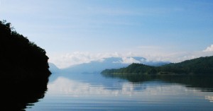
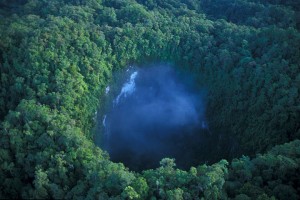
Lake Kamaka
©Laurent Pouyaud
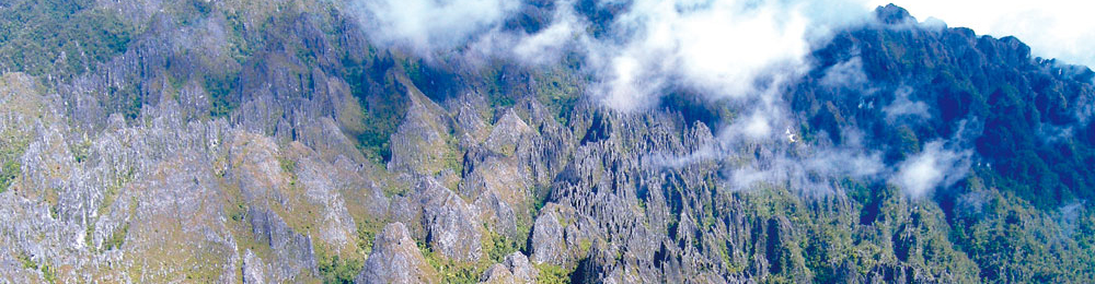
The Lengguru range is characterized by series of fold-and-thrust mountainous wedges culminating between 900 and 1,500 metres (3,000 to 5,000 ft.) separated by deep valleys, sometimes completely enclosed where the run-off of water gets lost in crevices – they are called endhoreic valleys.
The topography of Lengguru mainly consists of lime stone formations called “karst”, designed over the latest millions of years by the combined action of run-off water and dissolved carbon dioxide.
This rough and rugged terrain is the shelter for a multitude of natural labyrinths, on the surface or underground, and its maritime part. As many original ecosystems such as lapiez, poljes, siphons, dotted rivers and numerous endhoreic lakes, dolines, caves and underground networks. Altitude, depth, humidity, isolation, salinity and temperature maintain a mosaic of ecological niches, which favour the adaptation and evolution of species.
Lapiez and high forests
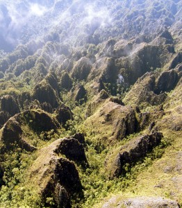
Lapiez
© Vivien Bailly
Lapiez are cracked and eroded lime stone plateaux, covered with various forest habitats depending on the altitude, the geological substrate, the exposure to dominant winds, monsoons, and their level of isolation. Papua biodiversity being known to increase with altitude, these unexplored environments are potential havens for unique and unknown animal and vegetal communities.
Poljes, endhoreic lakes, dotted rivers
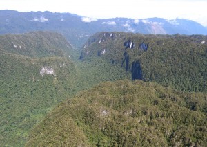
Polje
© Vivien Bailly
Poljes are large, elliptic depressions taking the shape of canyons or valleys, which sometimes shelter endhoreic systems such as marshes or lakes. The water disappears in the depth of the karst, sometimes as submerged siphons or underground rivers referred to as “dotted” – divided into open air sections (on the surface) and underground sections.
The most ancient poljes, at the heart of Lengguru, date back to the times when the massif was formed, 10 million years ago. Isolated by steep cliffs, these poljes probably host an unexpected biodiversity as well as living remains of the past biodiversity.
The real challenge for the expedition scientists is to wait until they can explore these isolated areas, probably never visited by Homo Sapiens.
Dolines, caves, underground networks
Doline
© Gilhem Maistre
Dolines are circular depressions caused by erosion and the collapse of lime stone in a karst environment. From a few tens to several hundreds of metres in diameter, they are sometimes, just like caves, a gateway to the underground world and several kilometres of network.
Biodiversity in underground tropical karst environments has hardly been studied. These habitats are known however to host a more significant proportion of endemic species than any environment on the surface.
The stability of underground environments and the age of underground cave systems sometimes allow relict species to survive, which can no longer be found on the surface. Their discovery may help the identification of missing links, thus leading to a better understanding of the evolution of terrestrial groups.
When they are old enough, karsts may host hypogeum species such as blind fish or crustaceans. These species have adapted to underground environments, and generally feature a de-pigmented body, an extended sensory system and blindness.
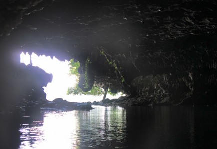
Maritime karsts and reef slopes
Maritime karst
© Régis Hocdé
The Lengguru frontal zone plunges more than 2,000m (3,300 ft.) into the Seram Sea. Like its emerged part, it is a karst network submerged by the sea. This karst was formed during the various maritime regressions, and equally hosts a broad variety of habitats such as caves and immersed underground networks, fresh water seepages (Vruljas), canyons and fossil valleys, coastal maritime lakes and numerous reef slopes.
These unknown environments will be explored vertically by teams of divers equipped with recycled systems down to depths of approximately 100m (330 ft.),